-
Contemporary Fiction
- Contemporary Fiction
-
Children
- Children
-
Comics & Graphic Novels
- Comics & Graphic Novels
-
Non-Fiction
- Non-Fiction
-
Fiction
- Fiction
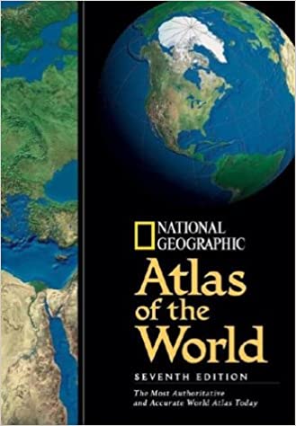
Seventh revised edition of an atlas of the world which contains political and physical maps, temperature and rainfall charts and a gazetteer, as well as flags and other information for each country.
Amazon.com Review
Flip through the pages of this impressive book and you will feel as though the world is literally at your fingertips. Full-page spreads are devoted to more than 75 political and physical maps (political maps show borders; physical maps show mountains, water, valleys, and vegetation). There are many new touches to be found in this edition, including increased usage of satellite images, an especially helpful feature when researching the most remote regions of the earth; more than 50 updated political maps that record the impact of wars, revolutions, treaties, elections, and other events; and the use of the latest research on topics such as tectonics, oceanography, climate, and natural resources. The sheer size of the atlas's index--134 pages--offers insight into just how much information is packed into 260-plus pages. The book is so physically large, in fact, that when it's open, the reader is staring at three square feet of information, a surface area larger than many television screens. The potential uses of this book for a family are vast, from settling a friendly argument to completing a school report. In the end, though, the atlas is still mostly about maps. Pages and pages of maps. Maps that force us to see how wonderful and dynamic our world is. Maps that remind us of where we've been and where we'd still like to go. --John Russell
Review
About the Author
- Home
- Non-Fiction
- National Geographic Atlas Of The World 7th Edition
National Geographic Atlas Of The World 7th Edition
SIZE GUIDE
- ISBN: 9780792275282
- Author: National Geographic
- Publisher: National Geographic
- Pages: 280
- Format: Hardback
Book Description
Seventh revised edition of an atlas of the world which contains political and physical maps, temperature and rainfall charts and a gazetteer, as well as flags and other information for each country.
Amazon.com Review
Flip through the pages of this impressive book and you will feel as though the world is literally at your fingertips. Full-page spreads are devoted to more than 75 political and physical maps (political maps show borders; physical maps show mountains, water, valleys, and vegetation). There are many new touches to be found in this edition, including increased usage of satellite images, an especially helpful feature when researching the most remote regions of the earth; more than 50 updated political maps that record the impact of wars, revolutions, treaties, elections, and other events; and the use of the latest research on topics such as tectonics, oceanography, climate, and natural resources. The sheer size of the atlas's index--134 pages--offers insight into just how much information is packed into 260-plus pages. The book is so physically large, in fact, that when it's open, the reader is staring at three square feet of information, a surface area larger than many television screens. The potential uses of this book for a family are vast, from settling a friendly argument to completing a school report. In the end, though, the atlas is still mostly about maps. Pages and pages of maps. Maps that force us to see how wonderful and dynamic our world is. Maps that remind us of where we've been and where we'd still like to go. --John Russell
Review
About the Author
Related Books
User reviews
NEWSLETTER
Subscribe to get Email Updates!
Thanks for subscribing.
Your response has been recorded.

India's Iconic & Independent Book Store offering a vast selection of books across a variety of genres Since 1978.
"We Believe In The Power of Books" Our mission is to make books accessible to everyone, and to cultivate a culture of reading and learning. We strive to provide a wide range of books, from classic literature, sci-fi and fantasy, to graphic novels, biographies and self-help books, so that everyone can find something to read.
Whether you’re looking for your next great read, a gift for someone special, or just browsing, Midland is here to make your book-buying experience easy and enjoyable.
We are shipping pan India and across the world.
For Bulk Order / Corporate Gifting
 +91 9818282497 |
  [email protected]
Click To Know More
INFORMATION
POLICIES
ACCOUNT
QUICK LINKS
ADDRESS
Shop No.20, Aurobindo Palace Market, Near Church, New Delhi


